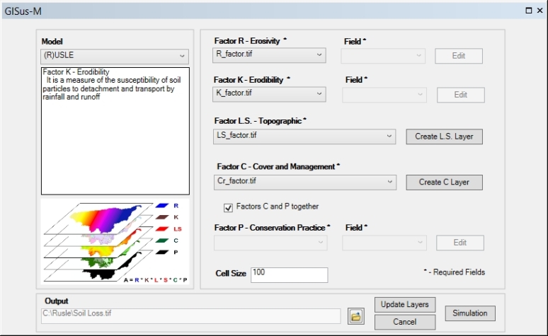
The input data to the system include: rainfall erosivity map (R-factor), soil erodibility map (K-factor), digital elevation model (DEM) which is used to compute the topographic factor (slope length and steepness factor), a cover and management map (C-factor), and support/conservation practices map (P-factor). Vector and raster data are supported in GISus-M. When user inputs a vector data, the system provide editing tools to edit the attributes of features within a specific layer.
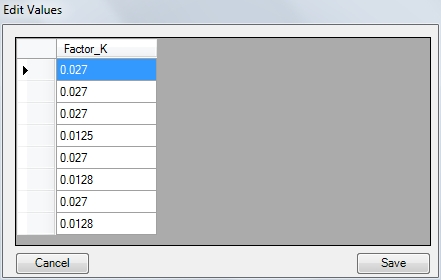
If the user is interested in change values for each attribute, GISus-M provides an interface which can be used to edit a layer. Hence, the user can create different sceneries of sediment yield into watershed